Tuesday afternoon in Moab
At the mouth of the road to Canyonlands is a nice little breakfast and wifi place I discovered last time, which I quite like! It’s got a weird designed-by-committee feel – a dinosaur theme. Along with the restaurant there’s a gift shop and some kind of “theme park”. I think it’s a Native American place and maybe as such gets federal subsidies. The servers are all pleasant, shy native American kids. My Arugula Burger was interesting and very tasty. They have good wifi and leave you alone to enjoy it.
The Colorado River is 20 minutes (recall that I was > 2000 feet above the river this morning), and tonights campground is ten minutes up the river, so the rest of the afternoon is whatever I feel like doing in and around Moab. What I feel like is checking out Arches National Park instead of driving right past it as I have every time for the last few years. As soon as I got in line at the entrance gate I was reminded why I drive past. Just getting in was a pain in the ass. One of those huge bus-sized RVs idling at the gate nattering at the ranger for a fucking long time, oblivious to the line of cars piling up behind him. It was so bad that the ranger actually thanked me for having my card ready when I drove up. Doesn’t everybody? :<
Finally the ponderous RV went to the RV parking so I could slither past and park and go into the Visitors Center. What I really wanted to do was see if there’s a relief map. There was and it was real interesting. Among other things I discovered that the back corner of the park almost touches the river near where I camp. A useless factoid, but but now when I’m looking across the river I’ll know I’m looking at the National Park!
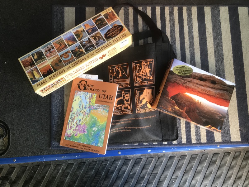
For whatever reason, today is the day when I finally bought Roadside Geology of Utah. I’ve checked it out of the library and brought it on a couple of trips, but really, I am enough of a geology geek that I should have my own. [stupid update: when I got home I realized I did this before, and now own TWO copies … sigh] I also randomly decided to buy a couple of jigsaw puzzles, and my total expenditure was just a bit over $60, so I randomly scored super cool Arches tote bag. I’m on a roll!
Aaaaand … that’s as far as I got in Arches National Park today. The rest of the park is up a 1,200′ or so incline, basically up on the same Kayenta sandstone plateau as Island in the Sky. Following the ponderous RVs all the way up there and fighting them at every parking area just didn’t appeal. I drove to the south end of town and visited City Market. It’s a great store. Sadly I didn’t need much, and they don’t sell wine, so I just got a 12 pack of Uinta beer and charmed the lady into keying in a discount card number :)
Back to the north end of town, take a right at the river and head up to:
WHUFU page for: Oak Grove Campground
One more in the string of handy, heavily used campgrounds up the Colorado River on Utah 128 from Moab.
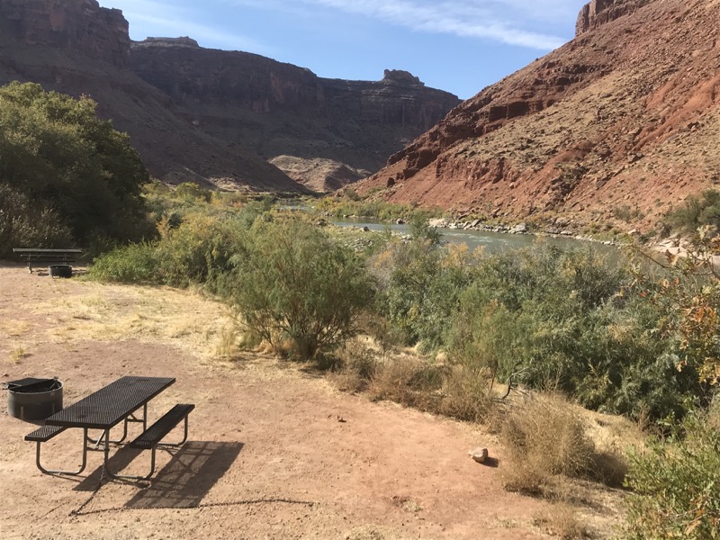
This one is past Drinks Canyon CG, and right before Big Bend CG. It's very small, 7 sites.
So named I think, because sites 6 and 7 re hidden away in a little grove of scrub oak.
tonight:
Site 2 appears to be the only one with a remotely level parking pad. It's also very pleasant. The giant butte across the river puts it in shade most of the afternoon, at least in October.
Sad to report that when the wind shifts a strong poop smell wafts over my picnic table. Even though the pit toilet is 50 yards away. Oh well ...
This whole string of campgrounds is basically a bedroom community for Moab, so even though it was quite lovely and peaceful till dark, it was very busy with headlights and door-slamming in the 8-10:30 range, i.e. after dinner in Moab.

It’s 5pm, an hour and a half till sunset. No phone bars, so I won’t be able to fritter the evening away clicking on Twitter. I will be forced to fritter the evening away the old fashioned way, blogging and reading Roadside Geology – woo!
Wednesday (Oct 23)
Stop at the junction, fill my water bottles. Two miles to Eclectica, my go-to dining spot in Moab. The food was not very good this time – everything was a little overcooked and the danish was was not tasty at all – a giant wad of dough with icing. The place is still great though. I’ll be back again and hope for better luck on the food.
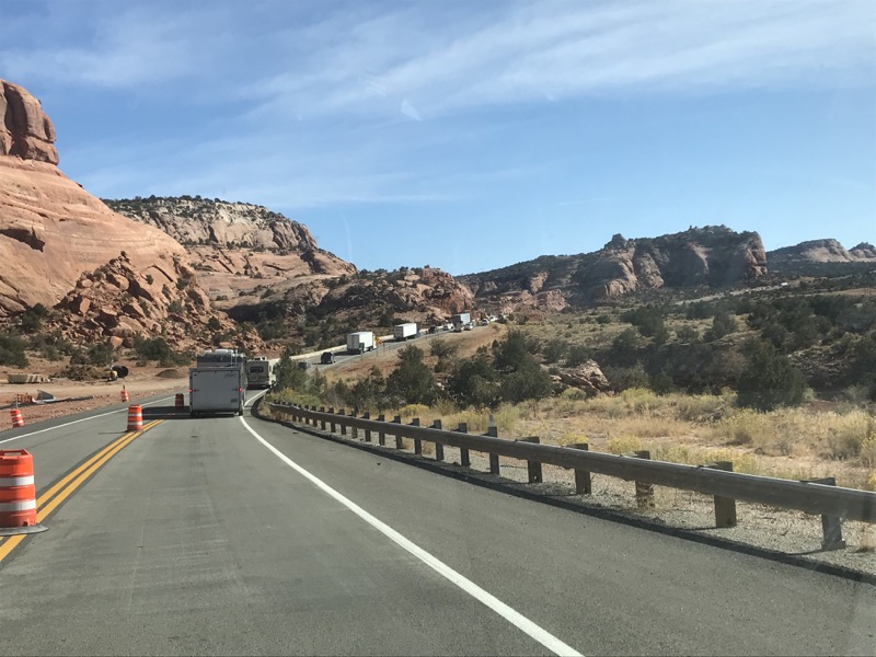
At the south end of town there was an insanely long parade of trucks and cars coming the other way. I thought “WFT?” but then 20 minutes later it all became clear – a big-time traffic stop for blasting two more lanes out of the road cuts. Evidently they’ve decided this busy road needs more lanes.
Got me some fried chicken in Monticello. An unfortunate choice as we will see later. I stayed in a motel here and spent the evening at the library 15 or so years ago and I’ve liked Monticello ever since. The opposite of how I feel about the next town, Blanding, which I have always found to be utterly unlovable in every way. It’s restaurants are terrible, it has a pinched, uncharitable feel to it. It is the last civilization for quite a while, so I did get diesel there, and had a little vignette at the gas station apropos of that feeling. I was listening to a Chris Hayes podcast when I pulled in and left it going with the door open as I filled up. There was a dude filling up his giant white pickup truck on the other side of the island. He could clearly hear whatever takedown of Trump that Hayes was engaged in at the moment and he was not amused. I even got a pretty harsh stinkeye as I was pulling out … Same to you buddy.

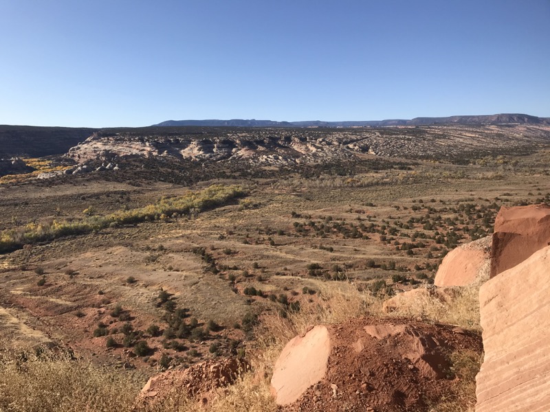
Today’s route was pretty much due south on US 191 until Blanding, after which you round the corner and take a right on Utah 95 to start heading north and west through even more spectacular slickrock country. The very most exciting thing on the early part is the road cut through Comb Ridge above Comb Wash. Comb Ridge is quite a spectacular sight coming the other direction, but on this side, the high side, it’s just another bump in the juniper-dotted hill country as you approach it. Then at the far end of the road cut an amazing panorama opens up. I was ready for it and parked on the far side to soak it all in. The sunlight makes the (relatively) freshly cut red sandstone seem to glow.
That spot has a panoramic view of Comb Wash, and even though it was tonight’s goal it didn’t look like a fun place to stay tonight. The fall color is long gone, cottonwoods are bare, and from up here the few campers looked like homeless people. The road sign said 45 miles to Hite, where I knew I could find a quite nice place to stay on the shores of Lake Powell. So I keep going, with the notion of looking for a likely dispersed camping spot, and if I don’t find one, I will get to Hite soon enough.
WHUFU page for: White Canyon dispersed
Somewhere between Natural Bridges NP and Lake {Powell (Hite UT) there is a sign to turn off for a Historical Marker. On that turnoff there is at least one really quite nice place to camp. There was already a fire ring, so I know it's OK!
A couple of miles south of the Jacobs Chair sign.
tonight:
The parking area is about 30 yards from the edge of the White Canyon cliffs. I took my table and chair out there and had a great time.
Sitting here on an outcrop of White Cedar Sandstone thanking the Universe for blessing me with nights like this.
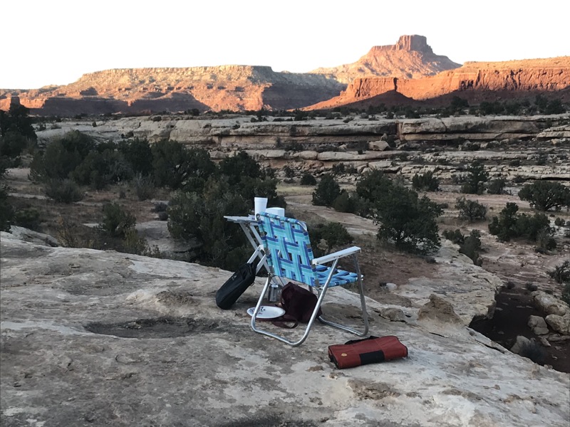
I drove past Fry Canyon (never got to stay at that place before it closed), and was making my way leisurely through beautiful White Canyon when I spotted a likely turnout. I took it, and a few hundred yards in was a nice, level parking spot 40′ from the edge of White Canyon. What an amazingly perfect spot! I’m within sight of the road, but there’s not traffic in the evening – not much traffic ever, I think. My third really nice dispersed camping spot so far. Driving on in the morning I find that it is couple of miles south of the Jacob’s Chair viewpoint sign, just fyi…
Thursday
I went to bed very happy with my beautiful spot, but started feeling bad in the middle of the night. When you’re older and have had a scare or two, something like this causes a lot of stress along with the physical discomfort – it could be anything from trivial to catastrophic. By morning it seemed clear this was not catastrophic, but even garden variety food poisoning kinda sucks, so that’s where we are today – ugh! Which brings us the occasional downside of dispersed camping – sometimes you really, really, really need a toilet. So, much as I loved being in this excellent spot, I didn’t hang around very long in the morning.
About 15 miles down the road there was what appears to be the staging area for some kind of mining(?) work, a couple of flatbed trailers and … a porta-potty on a trailer! Woo! There’s a carabiner keeping it shut, but it’s not locked and after a few uncomfortable seconds fiddling with the latch I hop in and do my business. Ah, much better!
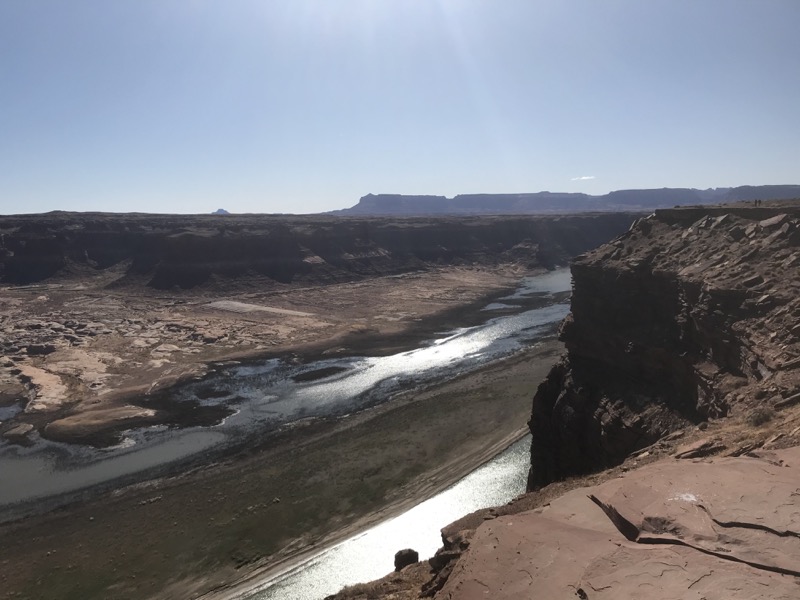
With THAT off my mind I can more or less enjoy this beautiful drive. The road descends to the level of the Colorado River at the very top of where it becomes Lake Powell, then ascends back up to the top of the slickrock the rest of the way to Hanksville. It’s a super interesting stretch of road. The road down with the turnoff to Hite, the spectacular Hite Crossing Bridge over the Colorado, then the equally cool bridge over the Dirty Devil River, then short drive at river/lake level where dispersed camping also happens. Back on top I pull off at the “must stop” Hite Overlook to soak up the amazing view of the sadly depleted lake, Hite, and the canyon.
On to Hanksville, where I had planned to stay at Duke’s Slickrock Campground, but I’m here way too early in the day. There is wifi and phone reception at Duke’s Slickrock Grille, so get lunch I research a new plan. One of the three campgrounds in the next town down the road, Torrey, has $20 tent sites, so that’s the new plan.
For my money, the stretch of Utah 24 from Hanksville to Fruita is to me the most interesting stretch of highway in all of Utah, and that’s saying something! Heading west from Hanksville, there’s a stretch of green piles of rock, a lot of yellow piles of rock with a few magenta/violet piles of rock for variety, and this amazing cavalcade of grey-black shale outcrops that march along one after another for five or so miles. Roadside Geology of Utah tells me it’s the Mancos shale again, sort of a tilted version of the Book Cliffs down at road level. Whatever, it’s all amazing.
The road more or less follows the Fremont River all the way to Fruita. It’s a pretty wide valley through all those magically carved and colored hills, but at the edge of Grand Escalante Park it narrows into a really scenic canyon. A little waterfall and rapids, the coolest stop on the whole road, has been completely barred to the public for some stupid reason, so I just press on to Fruita. Do not even try to find parking at the always busy Visitors Center, rather head directly to the lovely picnic area … which is particularly lovely in the fall. The fact that I never actually walked around the park tells you everything about how shitty I feel today. I parked, went straight for the bathroom, then returned to the van, slept for an hour and left. Not a great day for me.
WHUFU page for: Sandcreek RV Park and Campground
Pleasant, well laid out, reasonably priced campground.
tonight:
I spent all my time here in my sleeping bag waiting for a food poisoning episode to work its way out of my system so I can't say I had an awesome time, but everybody else seemed to be having a great time!
There are three campgrounds at Torrey. This one has the best price on no-hookup camping. I like it a lot. I’m close to the bathroom, the wifi is very good AND I get phone reception. I however am still a mess though. I take my first shower since Sunday morning then go to more or less straight to bed at around 5:30 (still daylight) and stay there till morning. There were two different large groups having very social campfires that I could see out the windows. They no doubt wondered about the weirdo who never even stuck his head out of his van all night, but sorry, I’m sick.
Leave a Reply